by Mike Churchill
On 27 November, 2007, Google released an update to Google Maps: they are now including terrain as an optional view. This is especially cool for high-relief areas (mountains, hiking trails, and the like). For example, here are three views of the Grand Canyon:
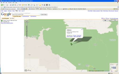
The ‘Map’ view is pretty boring, and other than showing the size of the National Park and its boundaries, does little to convey the grandeur of the location.
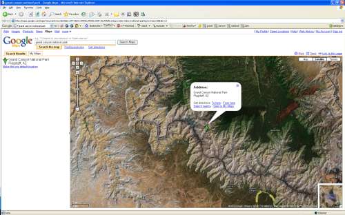
The ‘Satellite’ view gives a better overview, but rather than helping, the various colors of the real terrain create a confusing image.
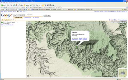
The new ‘terrain’ view gives the best impression of the feel of the location: the deep rift is clearly visible and the correlation between the valley and the park boundaries are clear. In addition, there are labels identifying certain landmarks. In city locales, the terrain view shows large buildings as well.
This new feature comes at a cost, however: while the terrain view is new, the ‘hybrid’ view which displayed the satellite imagery with the roads overlayed is now a sub-option under the ‘satellite’ view. Choose the ‘satellite’ view, and a “Show Labels” checkbox becomes available when hovering over the satellite button. Selecting the checkbox will generate the hybrid view. The hybrid view shows vegetation and other non-geological features, so the two views offer complementary insight into certain areas.


